Twenty acres inside the bend of a river the Dakota named twice, in a cession that worked out to fourteen cents an acre — about a hundred and sixteen dollars for this whole park in today's money — taken up with a certificate Congress had forbidden anyone to sell, and platted by a widow living in New York ten years before she moved here.
One
A country with names.
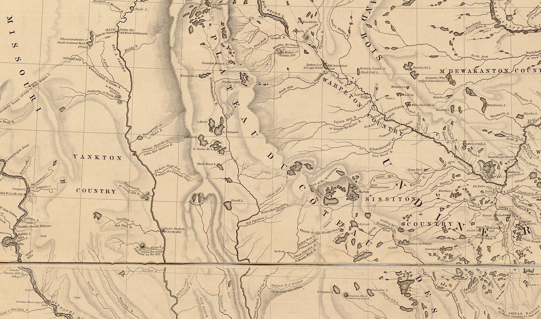
Before 1859 no line on any map separated these twenty acres from the prairie around them. What the maps carried instead were the names of the people who held the country. Joseph Nicollet's map of the upper Mississippi basin, compiled for the War Department out of four seasons in the field and published in 1843, letters the ground west of the Big Sioux Yankton Country and the ground east of it Sissiton, Warpeton and M'Dewakanton. Those are bands of the Očhéthi Šakówiŋ, the Seven Council Fires. In Dakota accounts the land they are drawn on is Mní Sóta Makoce, a homeland that runs well past the present state line into eastern South Dakota.
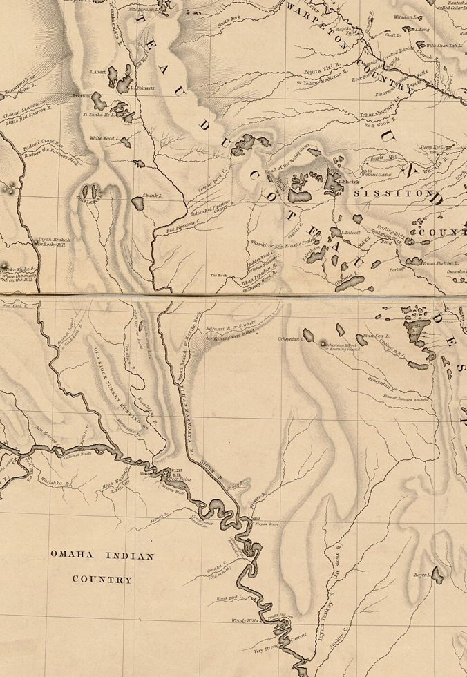
The Big Sioux runs down the middle, lettered Tchankasndata R.; the prairie west of it is Yankton Country, the country east of it Sissiton and Warpeton. Nicollet, 1843; Library of Congress, via Wikimedia Commons; public domain.
The river itself is named twice in the printed record, by two men who asked Dakota speakers and wrote down what they were told. Neither name was invented for a map.
Nicollet, Report Intended to Illustrate a Map of the Hydrographical Basin of the Upper Mississippi River (1843)
“This is the Big, or simply the Sioux river, and is one of the most importance to the country through which it flows. Its Indian name means that it is continuously lined with wood.”
Nicollet's own gloss on the marginal name Tchan-kasn-data river, or Sioux river. The first element is čhaŋ, wood. His editors note that his Dakota transcriptions are systematic and precise.
Stephen Return Riggs, Grammar and Dictionary of the Dakota Language (Smithsonian Institution, 1852)
“i-pa’-ksaŋ, n. a bend in a river, etc. … Mde ipaksaŋ, Big-Stone Lake; Wakpa ipaksaŋ, the Big Sioux river.”
Compiled with Dakota speakers one year after the treaty of Traverse des Sioux. Related entries in the same dictionary: paksaŋ, to bend; o-i-paksaŋ, a bend, crook, angle; wakpá, a river.
Both names describe this ground exactly. Traced from the channel geometry, the river runs south past the falls, loops east and comes back south again; the park lies inside that loop, about a mile and a quarter west of the natural channel. Twenty wooded acres inside a bend is what the two names say.
For the twenty acres themselves nothing is recorded, and nothing should be invented. Dakota naming attached to water and to use, not to a rectangle of prairie a mile and a half south of the falls that no surveyor had drawn before 1859 and no plat before 1883 — and the people who would have known any name for it were driven out of the region in 1862, twenty-one years before the plat. What that ground should be called today is a question for Dakota speakers to answer, not for a web page.
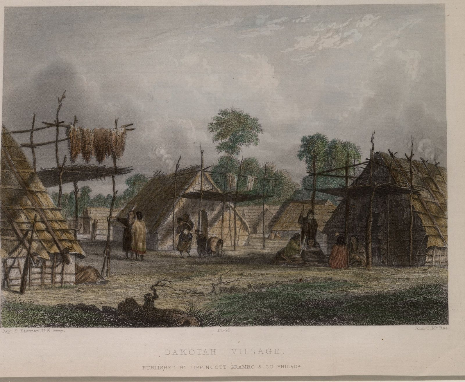
The Big Sioux, lettered Tchankasndata R. and, below it, Sioux R., 1843.Bark houses and drying corn, 1850s, engraved after a drawing by Capt. Seth Eastman; public domain.
Two
The river decides which treaty.
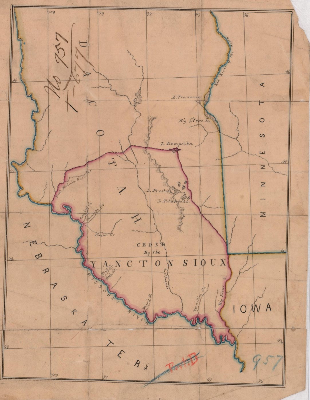
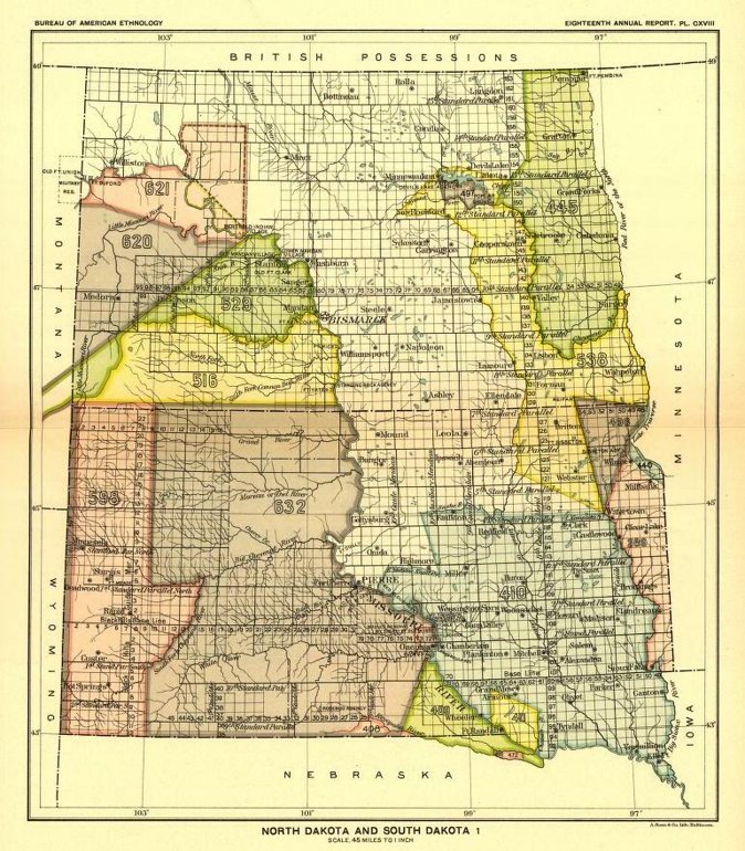
Two cessions meet at the Big Sioux, and which one governs a given parcel in Minnehaha County depends on which bank it sits on. Bailey, writing the county's history in 1899, states the geography plainly: the 1851 treaty of Traverse des Sioux covers the part of the county lying east of the river, and the 1858 treaty with the Yankton covers the part lying west of it. The park is west of the river. The ground under it is Iháŋktuŋwaŋ land, ceded at Washington on 19 April 1858, inside the tract catalogued by Royce as cession 410.
The ceded country as the Office of Indian Affairs drew it, bounded east by the Big Sioux and north at Lake Kampeska. National Archives, via the Digital Public Library of America; public domain.Cession 410, the Yankton treaty of 1858. The park is at its far eastern edge. Royce, Indian Land Cessions in the United States, plate CXVIII, 1899; public domain.
The treaty writes the river's Dakota name into the cession boundary itself. The ceded country begins “at the mouth of the Tchan-kas-an-data or Calumet or Big Sioux River.” The instrument that took the land is also, in two places, a record of what the land was called.
What the United States promised in return is set out in the fourth article, and it is not a purchase price. It is a schedule of allowances, payable over half a century, and revocable.
Treaty with the Yankton Sioux, 19 April 1858, article 4
“To pay to them, or expend for their benefit, the sum of sixty-five thousand dollars per annum, for ten years … forty thousand dollars per annum for and during ten years thereafter — twenty-five thousand dollars per annum for and during ten years thereafter — and fifteen thousand dollars per annum for and during twenty years thereafter; making one million and six hundred thousand dollars in annuities in the period of fifty years …
… or they may, at the discretion of the President of the United States, be discontinued entirely, should said Indians fail to make reasonable and satisfactory efforts to advance and improve their condition.”
11 Stat. 743. Article 12 adds that annuities may be withheld, in whole or in part and for as long as the President directs, for a violation of any stipulation of the agreement.
11,155,890acres ceded in 1858, keeping four hundred thousand
$0.14per acre, in annuities over fifty years
$2.80the park's 19½ acres at that average
$17,000the same ground, valued by a judge in 1907
The schedule began with the year of removal, and the Yankton moved onto the reservation in the summer of 1859, so its last tranche — fifteen thousand dollars a year for twenty years — ran to about 1909. That is roughly two and a half cents a year for this park, and it was still being paid when the city took the deed in 1906.
Those figures come from the treaty's own fourth article. The federal commission that valued this cession a century later counted the promise at $1,662,500, taking in the other sums the treaty pledged, against 11,168,371 acres: fifteen cents an acre, and $2.90 for the park. What either number is worth in present money, and what the same ground was worth to the buyers in the same year, is section five.
Three
The town was founded before the land was bought.
The men who founded Sioux Falls arrived in June 1857, a year and eight months before the Senate ratified the cession. That was not a grey area at the time. Congress had already defined the country they were entering and set a penalty for entering it.
Act of 30 June 1834, sections 1 and 11
“That all that part of the United States west of the Mississippi, and not within the states of Missouri and Louisiana, or the territory of Arkansas … be taken and deemed to be the Indian country.”
“That if any person shall make a settlement on any lands belonging, secured, or granted by treaty with the United States to any Indian tribe, or shall survey or shall attempt to survey such lands … such offender shall forfeit and pay the sum of one thousand dollars. And it shall, moreover, be lawful for the President of the United States to take such measures, and to employ such military force, as he may judge necessary to remove … any such person.”
4 Stat. 729 and 730. Section 12 of the same act voids any purchase of Indian land not made by treaty, and fines anyone who attempts to negotiate one.
On 23 May 1857 the territorial governor of Minnesota approved the charter of the Dakota Land Company, capitalized at up to four hundred thousand dollars and authorized to purchase or simply claim land in the territory, with twenty-year exclusive ferry rights on the Missouri, the Big Sioux and the James. Among the incorporators were Charles E. Flandrau, at that moment the United States Indian agent to the Mdewakanton and Wahpekute and within months a justice of the territorial supreme court, and James W. Lynd, a trader at the Lower Sioux Agency. The company's party reached the falls on 20 June 1857, found men from a Dubuque company already holding the water-power sites, and laid claim to an adjoining three hundred and twenty acres. Bailey's account of that claim names the ground it covered: the part of the city later known as Gale's Sioux Falls.
That the land had not been bought was the company's own working knowledge, not a later inference. A territorial legislator explained the moving of Minnesota's western boundary by writing that there was no land west of the river from which the Indian title had been extinguished, so the company procured an amendment to the enabling act.
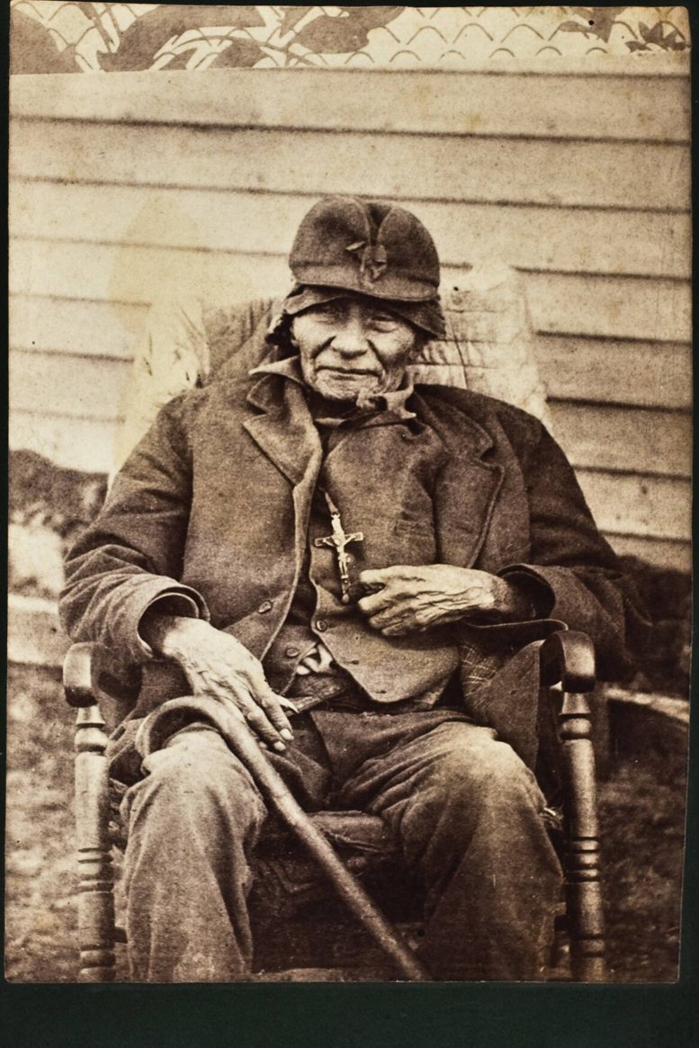
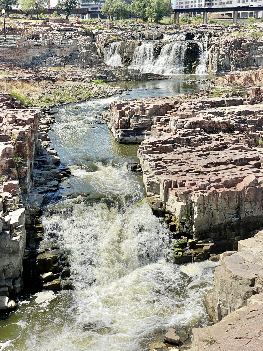
Pa-la-ne-a-pa-pe, “the man that was struck by the Ree,” the first of the sixteen Yankton names on the 1858 treaty, photographed thirty years later. Beinecke Rare Book and Manuscript Library, Yale University; public domain.The falls the companies came for, a mile and a half north of the park. Photograph by w_lemay, 2023, CC BY-SA 2.0, via Wikimedia Commons.
Letter from the settlers' fortified house, 17 June 1858
“One hundred lodges of Indians (Yanktonais) had arrived at that place and ordered our townsite men away … the Indians forced all hands out of the houses, took what provision they wanted and burnt every building down … Those Yanktonais … pretend to claim an interest in all the country owned and ceded by the Sioux Nation. They have been told that a treaty has been made with the Yanktons, but they will not recognize it until the first payment is made.”
“Fort Sod, Sioux Falls, D. T., June 17th, 1858,” reproduced in Bailey, History of Minnehaha County (1899). Written eight months before ratification. The first payment had not been made, and under the treaty it would not be made until the Yankton had removed to the reservation.
The treaty did provide for settlers already on the ceded land. Article 7 gives “all other persons (other than Indians, or mixed-bloods) who are now residing within said ceded country, by authority of law,” the privilege of entering a hundred and sixty acres at a dollar and a quarter. The qualifying clause is the whole of it: a settlement made in Indian country before cession was not made by authority of law.
Four
A certificate Congress had forbidden anyone to sell.
The park's two forty-acre tracts did not leave the public domain by homestead or by cash entry at a land office. They left it on Sioux half-breed scrip, and the statute that created that scrip contains one short proviso that governs the whole chain.
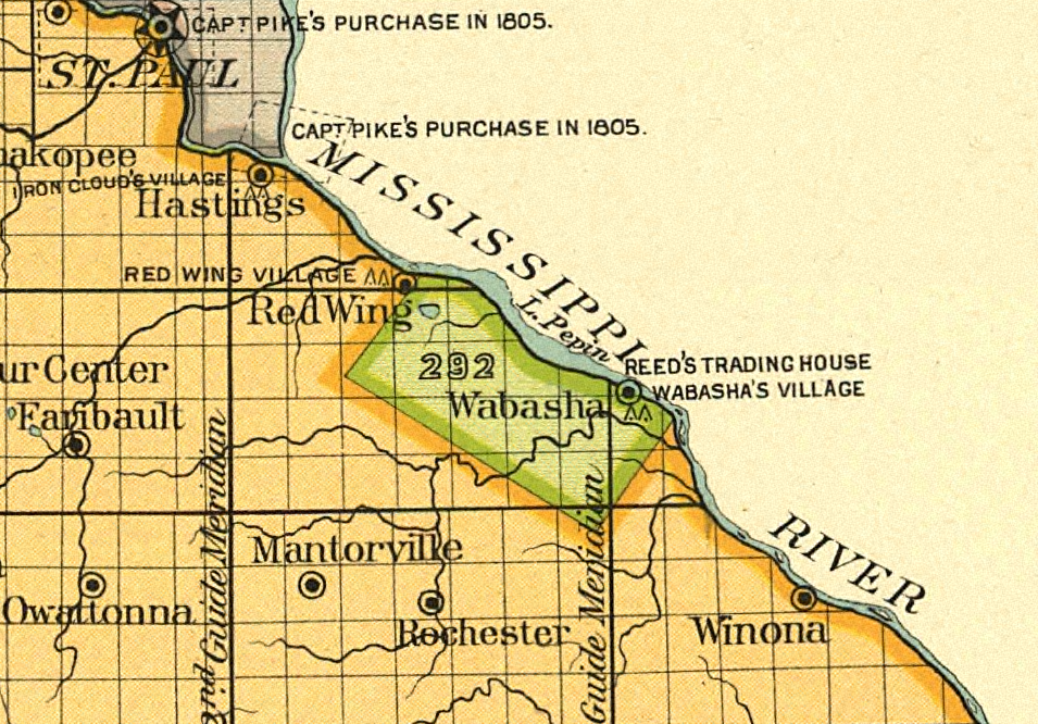
The ninth article of the 1830 treaty of Prairie du Chien set aside a tract on the west side of Lake Pepin for the mixed-blood relatives of the Dakota. In 1854 Congress offered to take that tract back: each person entitled to a share could relinquish it and receive instead a certificate locatable on public land somewhere else.
The Lake Pepin half-breed tract, cession 292, between Red Wing and Wabasha. Giving it up is what produced the scrip. Royce, Indian Land Cessions in the United States, Minnesota 1, detail, 1899; public domain.
Act of 17 July 1854, section 1
“… certificates or scrip for the same amount of land to which each individual would be entitled in case of a division of the said grant or reservation pro rata among the claimants — which said certificates or scrip may be located upon any of the lands within said reservation not now occupied … or upon any other unoccupied lands subject to pre-emption or private sale, or upon any other unsurveyed lands, not reserved by Government …
Provided, further, That no transfer or conveyance of any of said certificates or scrip shall be valid.”
10 Stat. 304, chapter 83. The scrip was a personal right, issued by name to individual mixed-blood Dakota in exchange for giving up a tract held for them by treaty, and by the terms of the grant it could not be sold.
One sentence in the county history
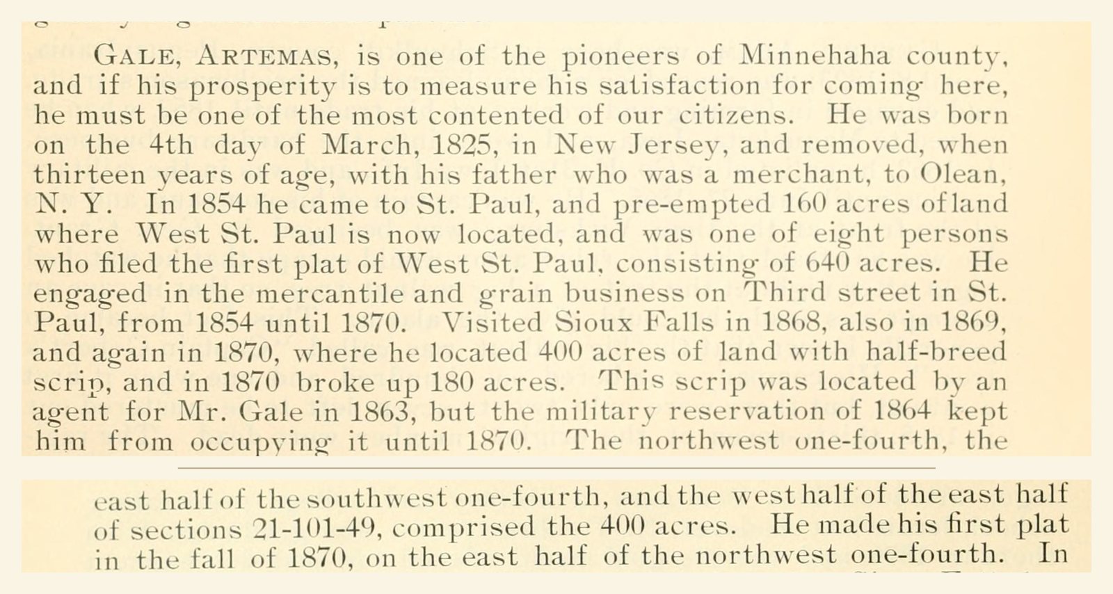
Dana Bailey's sketch of Artemas Gale — pioneer, St. Paul grain merchant, county commissioner, bank director, and Helen Gale McKennan's brother — describes how he came by his land here. It has been in print since 1899.
“… where he located 400 acres of land with half-breed scrip … This scrip was located by an agent for Mr. Gale in 1863, but the military reservation of 1864 kept him from occupying it until 1870. The northwest one-fourth, the east half of the southwest one-fourth, and the west half of the east half of sections 21-101-49, comprised the 400 acres.” Bailey, History of Minnehaha County (1899), pages 537 and 538, joined; scanned by the Internet Archive; public domain.
That description decomposes into exactly ten of the section's sixteen forty-acre tracts, which is four hundred acres; the arithmetic is the check on the reading. The east half of the southwest quarter is the pair of tracts McKennan Park sits on. The park occupies about seventeen and three-quarter acres of the southeast quarter of the southwest quarter and under three acres of the northeast quarter of the southwest quarter, of section 21, township 101 north, range 49 west of the fifth principal meridian.
Section 21 as the federal survey divided it: sixteen forty-acre tracts in one square mile. The outlined ten are the four hundred acres the county history describes as Artemas Gale's. Tract boundaries are Bureau of Land Management PLSS polygons; the park outline is the OpenStreetMap boundary, which measures 20.6 acres against the city's own figure of 19.51. Nothing here is drawn by hand.
Set the two documents side by side and the shape of the transaction is plain. The scrip was issued by name to mixed-blood Dakota and could not be transferred. Artemas Gale was a merchant from St. Paul. He did not locate it himself; an agent located it for him, in 1863. Whatever passed between the scrip holder and the agent, the statute says what its effect was.
The dates are worth reading slowly. The scrip was located on this section in 1863: the year after the war in Minnesota, the year after the Sioux valley settlements were abandoned and the valley left, in Bailey's words, almost deserted for nearly three years, and the same year Congress declared all treaties with the Sisseton, Wahpeton, Mdewakanton and Wahpekute abrogated and their annuities and claims forfeited. The preamble of that act concedes what it was doing: the United States had become bound to pay large sums, “the greater portion of which remains unpaid.” Then the ground sat. Fort Dakota was established on 1 May 1865 and the whole township set apart as a military reservation; the post was vacated on 18 June 1869, the reservation opened in 1870, and Gale came down from St. Paul, broke a hundred and eighty acres, and recorded one of the two earliest plats in Minnehaha County.
The one time a court looked
Sioux half-breed scrip reached the Supreme Court in 1892, in a case about the same statute, the same kind of certificate, and a city built on the land it was used to take. Sophia Felix received her certificate in 1857. In March 1860 she executed a power of attorney and a quitclaim deed, both blank as to the attorney, the land and the grantee; they came into the hands of a man named Patrick on payment of a hundred and fifty dollars. He filled in the blanks with a name of his choosing as attorney, his own as grantee, and as the description a hundred and twenty acres in Omaha that he already occupied without valid title. Her heirs learned of it in 1887 and sued. The Court took the transfer to be void, treated Patrick as holding under an implied trust, and then refused to disturb anything.
Felix v. Patrick, 145 U.S. 317, 333 (1892)
“The real question is, whether equity demands that a party, who, 28 years ago, was unlawfully deprived of a certificate of muniment of title of the value of $150, shall now be put in the possession of property admitted to be worth over a million. The disproportion is so great that the conscience is startled …”
The bill was dismissed for laches. The Court observed that the most which could justly be demanded would be the repayment of the hundred and fifty dollars, with interest. The city of Omaha kept the land.
No one ever brought the equivalent suit here, and what a court would have made of Gale's location in 1863 is now unanswerable in the only way that matters: the land has been a city for a century and a half. Felix is the reason titles in Sioux Falls are secure. It is also the plainest judicial description of how they were made.
Five
What it was worth, and to whom.
Fifteen cents an acre is a number that means nothing until it is set beside
something else. Three comparisons are available, and they do not say the same thing: what that
money would buy today, what the same ground was worth in the same year to the people buying it,
and what the United States itself concluded about the bargain a century later.
The promise, in today's money
There is no single conversion out of 1859 dollars, because a dollar can be measured against
prices, against wages, or against the size of the economy, and across a hundred and sixty-seven
years those three diverge by two orders of magnitude. The standard calculator for the job,
maintained by the economic historians who compiled the underlying series, reports all of them.
Measured against consumer prices, the entire 1858 promise of $1,662,500 is about
$66 million in 2025 money. Measured against average income it is about
$1.03 billion. Measured as a share of the economy — the fair way to price a tract
of land the size of a state — it is about $11.4 billion.
Spread over the 11,168,371 acres the Commission counted, that is $5.95 an acre in
today's prices, $92 an acre against income, $1,021 an acre against the economy. For the twenty
acres under this park, the first measure works out at about one hundred and sixteen
dollars.
$66Mthe 1858 promise in 2025 dollars
$5.95per acre, at today's prices
$116the park's 19½ acres at that rate
$8.3Mthe same acreage at 2026 assessed values
Conversions from MeasuringWorth (Williamson, Seven Ways to Compute the
Relative Value of a U.S. Dollar Amount), 1859 to 2025; its price series implies a factor of
about 40, the Minneapolis Federal Reserve's consumer price index a factor of about 36. The 2026
figure is the median assessed land value, $9.76 a square foot, on 48 residential parcels in the
McKennan Park historic district, applied to 19.51 acres. The park is tax-exempt and is not for
sale; the comparison is to the lots around it.
What the same ground was worth to the buyers, in the same year
The second comparison needs no waiting at all. In 1978 the Indian Claims Commission had to
decide what the ceded country had actually been worth on the day it was taken, and it did so
tract by tract. Most of Royce 410 it valued as farm and grazing land at $1.18 an acre. Three
places it refused to value that way.
Yankton Sioux Tribe v. United States, Docket 332-C, 43 Ind. Cl. Comm. 1, 20 (1978)
“It is clear from the foregoing that several townsites in Royce 410 would be easily recognized as such by a potential buyer in 1859. These townsites would, of course, be much more valuable than the other land in Royce 410. … we feel the sites of Yankton, Sioux Falls, and Vermillion should be valued as townsites.”
The same opinion records what happened on the ground: after the treaty “a large number of speculators, squatters, and townsite developers did invade Royce Area 410 lands despite the risk of resistance from the Sioux and ejection by the Army,” and “the Dakota Land Company hoped to locate the capital of the new territory at Sioux Falls.”
The Commission accepted an appraisal that laid 400 acres at the falls into standard lots of
seventy-five by a hundred and fifty feet, wrote off more than half of them as unsaleable, priced
the rest at $225 apiece, and discounted the total by fifty-five per cent for the time, expense
and profit of selling them. The figures in its own findings leave the Sioux Falls townsite worth
$105,705 in 1859, or $264 an acre.
Set that beside the fifteen cents an acre the treaty averaged. In the same year, on the same
tract, by the same tribunal's reckoning, the ground where this city stands was worth
about seventeen hundred times what was promised for it. The men who chartered the Dakota
Land Company in 1857 and claimed the falls before the treaty was ratified were not guessing at
that difference. It is why they went there first, and why they went there early.
Two instruments, and only one of them compounds
The deeper asymmetry is not in the price. It is in what each side was handed, because the two
sides were not handed the same kind of thing.
What the Yankton received was an annuity. It ran fifty years. It was payable only after
removal to the reservation. The President decided each year what share came as cash and what
share came as goods bought on their behalf; under the twelfth article he could withhold it, in
whole or in part and for as long as he chose, for any violation of the agreement, and under the
fourth he could discontinue it entirely if they failed to make “reasonable and satisfactory
efforts to advance and improve their condition.” An allowance of that kind cannot be sold,
pledged, borrowed against or invested. It does not compound, and it can be cancelled.
What the buyers received was fee simple title. A title can be platted into lots the week it
issues, mortgaged to raise the money that improves it, sold, resold, carried through a
depression and sold again. Artemas Gale's four hundred acres were located in 1863 and occupied
in 1870; part of them were town lots by August 1871; his sister platted the Boulevard Addition
across this ground in 1883; a judge valued twenty acres of it at $17,000 in 1907. Both sides
kept the bargain they signed. Only one of the two bargains could grow.
The ladder of prices on this one square mile, every rung of it from a public record:
$0.15 an acre
1858. Promised to the Yankton, in annuities over fifty years, revocable by the President.
$1.25 an acre
1858. The price at which the treaty's seventh article let qualifying settlers buy in.
$264 an acre
1859. The Commission's value for the four hundred acres of townsite at the falls.
$850 an acre
1907. A county judge's valuation of the park ground, in South Dakota's first inheritance-tax case.
$425,000 an acre
2026. Minnehaha County's assessed land value on the lots across the street.
In constant dollars the last rung is roughly seventy thousand times the first. Put the other
way round: one square foot of the ground facing this park is assessed today at more than an acre
and a half of it cost, in the same money, in 1858.
The United States agreed, a hundred and nineteen years later
None of this is a modern reading of old paper. The Yankton Sioux Tribe brought the claim
before the Indian Claims Commission, the tribunal Congress created in 1946 to hear exactly this
question, and on 31 August 1978 the Commission entered its judgment.
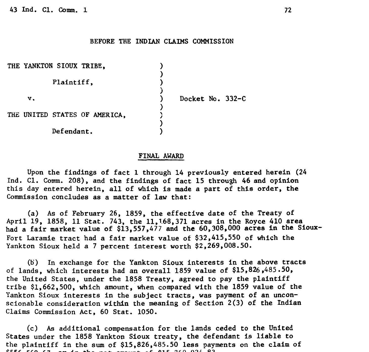
“… was payment of an unconscionable consideration within the meaning of Section 2(3) of the Indian Claims Commission Act.” Final award, Yankton Sioux Tribe v. United States, Docket No. 332-C, 43 Ind. Cl. Comm. 72 (31 August 1978). Public domain; digitized by the Oklahoma State University Library.
The order is also a record of what such a finding is worth. The Commission measured the loss
in 1859 dollars and added nothing for the hundred and nineteen years in between: the award is
the 1859 value, $15,826,485.50, less $556,560.67 of payments on the claim. Consumer prices rose
seven- or eightfold across that interval, so the money that changed hands in 1978 restored
something between a seventh and an eighth of the real value the Commission had just found was
owing. It was not the only such finding. In 1980 the Court of Claims held that the $600,000 paid
under the 1892 agreement, for reservation land it found worth $6.65 an acre, had been
“unconscionable and grossly inadequate.”
At the Commission's own 1859 figure for ordinary land in Royce 410, the ground under this
park was worth twenty-three dollars. The Yankton were promised two dollars and ninety cents for
it. The same ground sits today in a neighborhood where the county assesses land alone at about
eight million dollars for twenty acres, and the park itself is not for sale and never will be.
That is the whole of it: the twenty acres are now past pricing, and they were bought for less
than the cost of a meal.
Six
Helen Gale McKennan, of Albion and Rochester, New York.
The city's account of the park's donor is short and has been repeated for a century. She came to Sioux Falls for a short visit in 1874, returned east to marry a physician, and after her husband's death in the early 1890s came back to live here permanently. Two documents complicate the middle of that sentence, and both are easy to check.
The first is the Albion village chronology in Signor's Landmarks of Orleans County, New York, published in 1894. Under 1879 it records, among the year's fire-company business and village receipts, that Dr. William McKennan died August 21. The same volume's sketch of him adds that Helen Gale was his second wife, that his first marriage to Harriet P. Guild had produced two children, one then living in the West, and that the widow “resides in Rochester.” She was widowed in 1879, not in the early 1890s, and a widow's portion was shared with a surviving stepson.
The second is the plat schedule in Bailey's county history, which lists every addition recorded in Minnehaha County with its date, its book and its page.
Dana R. Bailey, History of Minnehaha County, South Dakota (1899), schedule of recorded plats
“Boulevard Addition, blocks 7-21. Platted by Melvin Grigsby and Helen G. McKennon, and recorded August 14, 1883, in book 1 of plats, on page 18.”
The spelling of her name is Bailey's. The twenty acres that became McKennan Park lie inside this addition. The National Register nomination credits Grigsby alone with platting it.
So she was a named principal in laying out this ground in August 1883, ten years before the city's story has her arriving, and she was doing it from New York. For roughly a decade the land that became the park was held by an absentee owner living on the Erie Canal, a thousand miles away. The money that went into Sioux Falls dirt arrived from the East well before the woman did, and the park is the end of a transaction that began as an out-of-state investment, not as a homecoming.
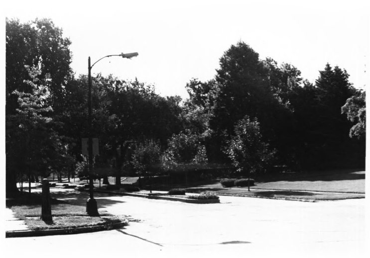
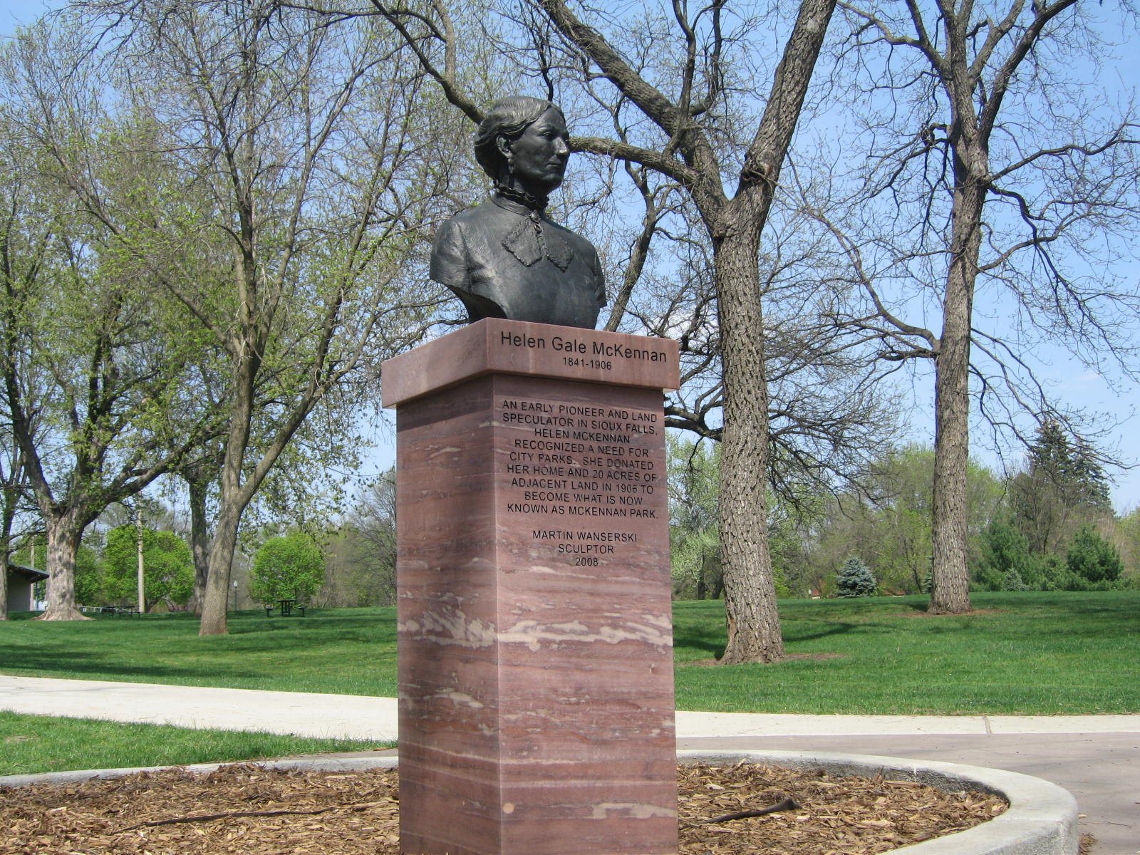
The boulevard of the 1883 addition, photographed for the National Register survey in 1983.Helen Gale McKennan, bronze by Martin Wanserski, 2008. Photograph by Missy Kitzman, Sioux Falls, 2010, CC BY 2.0, via Wikimedia Commons.
Where her money came from is not established, and the honest answer is that the surviving record does not say. The McKennan side does not supply it: the family were Irish immigrants one generation off the boat, Ezekiel McKennan a carriage maker who reached America in 1815, and the doctor who married her was his nephew. Her own father has not been identified in the Orleans County record. What the record does show is the brother. The city's own 2010 documentary puts it in one line — “Helen McKennan and her brother Artemus Gale were land developers” — and it was Gale who held the four hundred acres in section 21, and Gale who filed claim against her estate for twenty-two thousand dollars after she died.
She fell ill on 1 June 1906 and died at home on 29 September. Two deeds were recorded that day. The city received the house, five acres outright and a half interest in twenty more, on condition that the ground be a public park and that liquor be kept out of it. Both conditions have held for a hundred and twenty years. That is the gift, and it is real; this page is about where the thing given came from.
Seven
Seven markers, and the only Native thing named is the masonry.
The nineteenth-century record is a record of other people's decisions. What the park tells visitors is a decision being made now.
Seven interpretive markers stand in and around McKennan Park, erected between 1999 and the 2020s by the Minnehaha County Historical Society and the Friends of McKennan Park Neighborhood Association. Between them they cover the municipal band, the zoo, the controversy over the will, the pond and wading pool, the McKennan home, the miniature village, Lady Liberty and the Pillars of the Nation. None of them mentions the Dakota, the Yankton, or how the ground came to be available. The National Register nomination that listed the district in 1984 runs to forty-nine pages and does not mention them either.
There are two exceptions in the whole documentary record of the park, and both are about objects rather than people. The nomination lists, among the innovative landscaping, “a cactus bed, a minature mountain scene tableau with a powerhouse, a lily pond complete with a living alligator, a Japanese garden, and an Indian village.” That village was a model, built by park employees in 1931 and removed in 1961.
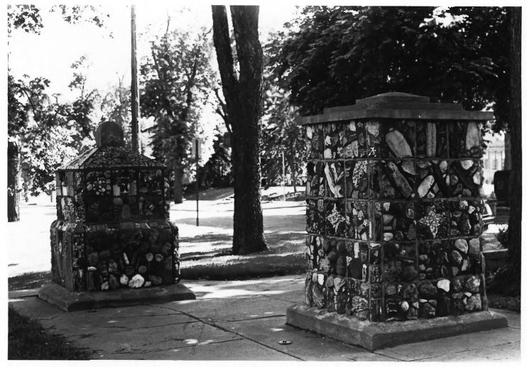
The second is still standing. In 1937 the park caretaker built two large stone posts at the west driveway; in 1941 two more joined them and the Chamber of Commerce named the set the Pillars of the Nation. The neighborhood association's own history records what went into the first two: they “were built out of decorative stones, fossils, and Indian artifacts.” The marker the historical society erected beside them in 2000 names the donor, Emil M. Christianson of Hills, Minnesota, who “had donated native South Dakota stone fossils and Indian artifacts to build the two older pillars.”
The Pillars in 1983. The two older posts, built in 1937, are the ones described as containing Indian artifacts.
No inventory of those objects appears in any city record found so far, and nothing identifies what they are or where they came from. Presumably they are still in the mortar, in a monument to the unity of the forty-eight states, on land ceded for fourteen cents an acre. That is the sentence the park has not yet written about itself.
Eight
A hundred and ninety-six years, on public record.
15 July 1830
At Prairie du Chien the ninth article of the treaty sets aside a tract west of Lake Pepin for the mixed-blood relatives of the Dakota. It is the origin of the certificates that later carry this ground out of the public domain.
30 June 1834
Congress defines everything west of the Mississippi outside Missouri, Louisiana and Arkansas Territory as Indian country, fines settlement or survey on treaty land a thousand dollars, and authorizes the President to remove settlers by military force.
17 July 1854
Congress offers scrip in exchange for the Lake Pepin tract, and provides that no transfer or conveyance of the scrip shall be valid.
23 May 1857
The territorial governor of Minnesota charters the Dakota Land Company with power to purchase or claim land. One incorporator is the sitting Indian agent to the Mdewakanton and Wahpekute.
20 June 1857
The company's party reaches the falls, finds a Dubuque company already holding the water power, and claims three hundred and twenty acres beside it. The Yankton still hold title.
19 April 1858
At Washington the Yankton cede 11,155,890 acres, keeping four hundred thousand, for annuities of $1,600,000 over fifty years.
June 1858
Yanktonai burn Medary and order the Sioux Falls townsite men out. A letter written from the settlers' fortified house on the seventeenth reports that the first treaty payment has not been made.
16 February 1859
The Senate ratifies. From this date the United States has something here to convey.
1859
Township lines are surveyed up the Sioux valley. Section 21 is drawn, and with it the sixteen forty-acre tracts that still describe this park.
1862
War in Minnesota. By October every settlement in the Sioux valley is abandoned, and the valley stays nearly empty for three years. The Dakota are expelled from Minnesota.
16 February 1863
Congress abrogates the treaties with the Sisseton, Wahpeton, Mdewakanton and Wahpekute and forfeits their annuities and claims, conceding in the preamble that the greater portion remained unpaid.
1863
An agent locates four hundred acres in section 21 for Artemas Gale, of St. Paul, with half-breed scrip. The park's ground is inside it.
1 May 1865
Fort Dakota is established and the township is set apart as a military reservation.
18 June 1869
The post is vacated; the reservation is opened the next year. Gale occupies his four hundred acres and breaks a hundred and eighty.
16 August 1871
Gale's Sioux Falls is recorded in book one of plats, page one, six days after the first plat in the county.
9 June 1873
The federal land office opens in Sioux Falls.
14 August 1883
The Boulevard Addition, blocks 7 to 21, is recorded in book one of plats, page eighteen, platted by Melvin Grigsby and Helen G. McKennan. The park's twenty acres are inside it. She is living in New York.
29 September 1906
Helen McKennan dies, and two deeds are recorded the same day. The city receives her house, five acres outright and a half interest in twenty more, on condition that the ground be a public park and that liquor be kept out of it.
October 1907
A county judge values the city's parcel at seventeen thousand dollars in South Dakota's first inheritance-tax case. The last instalments of the 1858 annuities are still being paid.
31 August 1978
The Indian Claims Commission finds the 1858 consideration unconscionable and awards the Yankton Sioux Tribe $15,269,924.83: the 1859 value of the land less payments on the claim, with nothing added for the hundred and nineteen years in between.
2026
Minnehaha County assesses land on the residential lots around the park at a median of $9.76 a square foot, about $425,000 an acre.
Nine
What is not known.
Whose scrip it was. Bailey names the holder of the land but not the holder of the certificate. The federal patent for the east half of the southwest quarter of section 21 should name the scrip, its number and the person it was issued to. That name is the one missing fact in this account, and it belongs in it.
How the ground reached Helen McKennan. Whether she bought this land from her brother or was given it is a question the Minnehaha County deed books answer in a line.
What is in the pillars. Two local sources say Native artifacts were mortared into the 1937 posts. The city parks department and Siouxland Heritage Museums are the places to ask, and the tribal historic preservation officers of the Yankton Sioux Tribe, the Flandreau Santee Sioux Tribe and the Sisseton-Wahpeton Oyate are the people whose answer governs.
What this ground was called. Nothing is recorded for the parcel itself. Two Dakota names for the river that bends around it are attested in print, one in 1843 and one in 1852; how either should be written today is for Dakota speakers to say.
Sources.
Treaty with the Yancton Tribe of Sioux, 19 April 1858, 11 Stat. 743; signed at Washington, ratified by the Senate 16 February 1859, proclaimed 26 February 1859 — articles 1, 2, 4, 7 and 12.
Act of 30 June 1834, "An Act to regulate trade and intercourse with the Indian tribes, and to preserve peace on the frontiers," 4 Stat. 729 — sections 1, 10, 11 and 12.
Act of 17 July 1854, 10 Stat. 304, c. 83, authorizing scrip in exchange for the Lake Pepin half-breed tract — section 1 and its provisos. Treaty of Prairie du Chien, 15 July 1830, 7 Stat. 328, article 9.
Act of 16 February 1863, 12 Stat. 652, abrogating the treaties with the Sisseton, Wahpeton, Mdewakanton and Wahpekute bands and forfeiting their annuities.
Felix v. Patrick, 145 U.S. 317 (1892).
Dana R. Bailey, History of Minnehaha County, South Dakota (Sioux Falls: Brown & Saenger, 1899) — the treaty geography; the 1857 claims; the letter of 17 June 1858; the schedule of recorded plats, including Gale's Sioux Falls and the Boulevard Addition; Fort Dakota, the military reservation and the land office; and the sketch of Artemas Gale at pages 537 to 538.
Isaac S. Signor, ed., Landmarks of Orleans County, New York (Syracuse: D. Mason, 1894) — the Albion village chronology for 1879, and the sketch of Dr. William McKennan and his two marriages.
Grant K. Anderson, "The Politics of Land in Dakota Territory: Early Skirmishes—1857-1861," South Dakota History 9, no. 3 (1979) — the Dakota Land Company charter and incorporators, the paper towns, and the 1859 survey.
Joseph N. Nicollet, Report Intended to Illustrate a Map of the Hydrographical Basin of the Upper Mississippi River (Washington, 1843), and Stephen Return Riggs, Grammar and Dictionary of the Dakota Language (Smithsonian Institution, 1852) — the two attested names for the Big Sioux.
Gwen Westerman and Bruce White, Mni Sota Makoce: The Land of the Dakota (Minnesota Historical Society Press, 2012).
McKennan Park Historic District, National Register of Historic Places nomination, reference 84003359 (prepared 1983, listed 6 June 1984) — the account of Helen McKennan, the landscaping inventory, and the 1906 deeds.
The McKennan Park Historic District, City of Sioux Falls government-access television, 2010 — "Helen McKennan and her brother Artemus Gale were land developers."
Friends of McKennan Park Neighborhood Association park history, and the Pillars of the Nation marker erected in 2000 by the Minnehaha County Historical Society — the stones, fossils and Indian artifacts in the two 1937 posts.
Yankton Sioux Tribe v. United States, Docket No. 332-C, Indian Claims Commission: opinion, additional findings of fact and final award, 43 Ind. Cl. Comm. 1, 30 and 72 (31 August 1978), with the title findings at 24 Ind. Cl. Comm. 208 (1970) — the 1859 fair market value of Royce 410, the valuation of the Yankton, Sioux Falls and Vermillion townsites, the finding of unconscionable consideration and the award of $15,269,924.83. Digitized by the Oklahoma State University Library.
Yankton Sioux Tribe v. United States, 623 F.2d 159, 178 (Ct. Cl. 1980), quoted at South Dakota v. Yankton Sioux Tribe, 522 U.S. 329, 338 n.2 (1998) — the 1892 agreement as “unconscionable and grossly inadequate.”
Samuel H. Williamson, “Seven Ways to Compute the Relative Value of a U.S. Dollar Amount, 1790 to present,” MeasuringWorth — every 1859-to-2025 conversion on this page. Cross-checked against the Federal Reserve Bank of Minneapolis consumer price index series, 1800 to date (Hoover and Rees estimates before 1913).
Minnehaha County property assessments for the 2026 assessment year, read from the county’s Beacon records: median assessed land value of $9.76 a square foot across 48 residential parcels in the McKennan Park historic district. Aggregate figures only; no parcel, owner or address appears on this site.
Land description and tract geometry: Bureau of Land Management PLSS CadNSDI, first- and second-division polygons for section 21, T101N R49W, fifth principal meridian, queried 11 October 2026. River channel and park outline: OpenStreetMap.